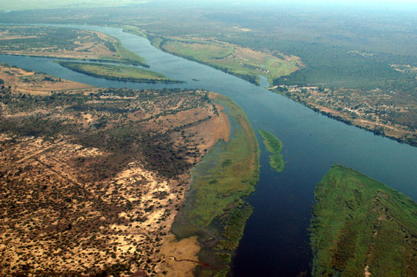
Here’s an odd bit of African geography: The finger of land in the upper left is Namibia, the region at the top is Zambia, Zimbabwe is at bottom right, and Botswana is at bottom left. Is the border between Zambia and Botswana long enough to permit a bridge to be built between the two? Or do the two peninsulas intrude far enough to make this impossible?
The answer isn’t clear. In 1970 Namibia had insisted that the four nations meet at a single point, meaning that the Kazungula Ferry linking Botswana and Zambia was illegal, as the border between them had no breadth. After an armed confrontation the ferry was sunk. Thirty-five years later Botswana and Zambia proposed building a bridge where the ferry had run. Is that geometrically permissible? The shaky consensus is that the two nations share a brief boundary of 150 meters between two “tripoints.” But the truth is as murky as the Zambezi itself.
(See Point of Interest. Thanks, Steve.)
