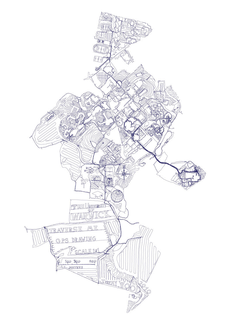
In 2010 Jeremy Wood walked around the campus of the University of Warwick with a GPS device to “draw” a map at 1:1 scale. Altogether he covered 238 miles in 17 days.
“He stayed in the Maths Houses on Gibbet Hill so the line through Tocil Wood to the Mead Gallery is exceptionally dark since it was walked so many times,” the university reports. “As he worked his way across the fields towards Kenilworth he began to ‘draw’ images associated with the University, from its crest, to a mortar board, to a globe in homage to the many ‘international’ centres that he encountered in his journeys. Reported to security several times for walking in ‘a suspicious manner’ around Claycroft and Lakeside residences, he soon disappeared from view, walking the countryside that surrounds the University but which is far removed from central campus.”
“I responded to the structure of each location and avoided walking along roads and paths when possible,” Wood writes. “Security was called on me twice on separate occasions and I lost count of how many times I happened to trigger an automatic sliding door.” More at his website and at GPS Drawing.
Somewhat related: Mathematician Jerry Farrell invented a two-player coin-pushing game played on a map of Butler University, his institution. Rebecca Wahl analyzed it in Barry Cipra’s Tribute to a Mathemagician (2005), and Aviezri Fraenkel of Israel’s Weizmann Institute of Science revisited it the following year (PDF).
