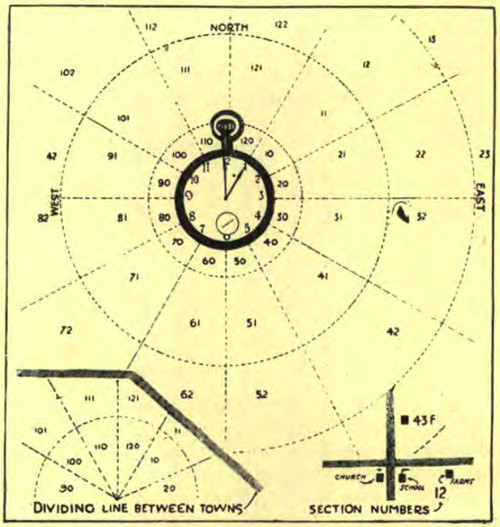
When cattle buyers had trouble finding John Byron Plato’s farm, they gave up and went home. “That killed a mighty profitable bargain,” he told a reporter, which “got me thinking about rural addresses.” The buyers had left a note saying “it takes time to find your place.” Plato looked at his watch and saw that it “smiled back the answer.”
Plato’s “clock system” assigns numbers to directions — 12 is due north, 5 is southeast by south, and so on. Within each of these sectors, a location can be identified by its distance from the town center. “Thus if a man lived four miles west of his post office, his number would be 94 (nine for west and four for distance). If he lived two miles south, his number would be 62.” This could be refined further by adding one more character: 32T means “about 2.75 miles east of the post office.”
Plato claimed that this system could have led his lost cattle buyers to within a hundred yards of his house without a map or a compass. He published a series of “rural directories” using the clock system in western and central New York State in the 1920s and 1930s, but his business faded as the Depression pummeled agriculture, and the patent lapsed.
