From the MapPorn subreddit:
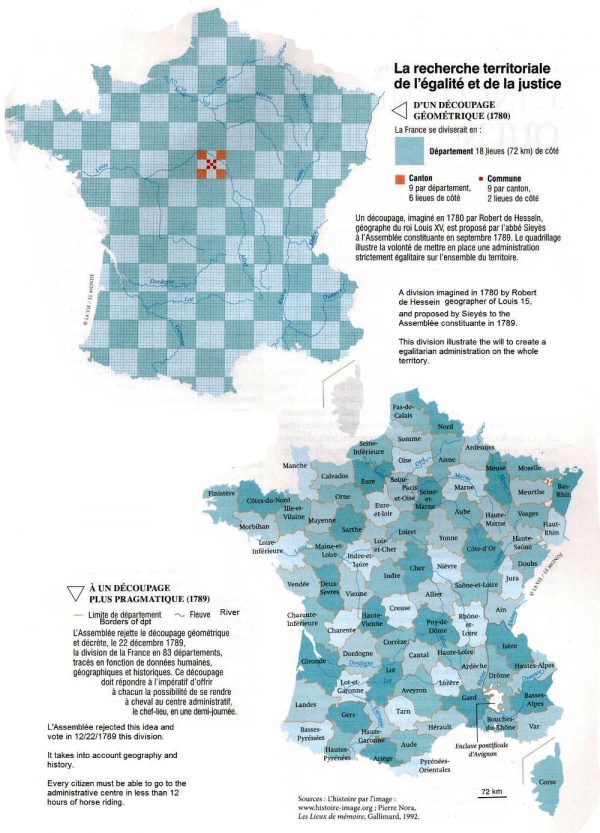
In 1789 political theorist Emmanuel Joseph Sieyès proposed dividing France into an egalitarian checkerboard of departments, cantons, and communes, following a plan conceived in 1780 by royal cartographer Robert de Hesseln.
The assembly rejected the proposal and adopted one that more closely followed the natural boundaries formed by geography and established by historical precedent.

